Rose and I went on a much needed warm weather vacation to sunny San Diego last week. I took my bike of course, since I wasn’t going to pass up the opportunity to get in some nice long outdoor rides in February. The forecast called for temperatures in the 70s with only a slight chance of rain on couple of days. Sweet!
I picked up a copy of the San Diego bike map before we went. That way I had a chance to plan routes from where we were staying in the Mission Hills area. The map was a huge help, but I soon found that bike lanes in San Diego aren’t exactly like the bike lanes here in Chicago. There the bike lane is often a narrow section of shoulder (with no pavement to the right of you) with traffic passing you at 55+ MPH on the left. Yikes. I couldn’t imagine riding these routes without a marked bike lane! With a little more research, I found routes for a few local team rides that were in lower traffic areas.
Here’s a brief description, map, and elevation profile for each of my rides. Click on any map to go to Everytrail.com for more details and to download a GPX track of the route.
Day 1 – 2/20/09
I arrived that afternoon and got to the hotel around 4 PM. I had to put my bike together and had planned on an easy 2 hour ride. I was smart to bring my lights, since I knew it would get dark around 6 PM. I opted for a route directly from our hotel. Hmmm. Within the first few miles, I had a good 350 foot climb. After that, the route was relatively flat. A good section followed a highway towards Miramar, but was well marked with a wide shoulder. I got lost a couple of times (hey, it was dark) even though I had my Garmin Edge 705 with me.
Day 2 – 2/21/09
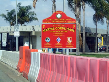
I was looking for a nice long ride along the ocean here in San Diego. After doing some research, I found that the old Pacific Coast Highway 101 here is a bit like Sheridan Road in Chicago. It’s got a bike lane and loaded with bike traffic on the weekend. The route wasn’t too hilly and it had plenty of food and water options along the way. I had to show my driver’s license to get into Camp Pendleton, but was awarded with brand new roads with wide shoulders and little traffic. The “tank crossing” signs were interesting, especially for someone used to “deer crossing” signs.
The main entrance into Camp Pendleton. Make sure to bring your ID!
Day 3 – 2/22/09
After yesterday’s ride, I needed to take it easy. I would have been happy to have a flat route, but there’s no such thing in San Diego. Rose wanted to run at Mission Trails Park, so I just explored the area around it. Well, I found lots of good climbs and few flat roads. I ended up just biking back and forth several times on the park road. I’m not complaining about the warm weather compared to what we’ve had in Chicago. We missed the Amgen Tour of California, but caught the finish on TV.
Day 4 – 2/23/09
I found some good rides north of San Diego from the Swamis team website. The route below had a nice gradual climb, but it was mostly on high traffic roads. I loved not having a traffic light every block, so I was able to open up for longer stretches. The one thing I didn’t like about San Diego is that the traffic lights are much longer compared to Chicago.
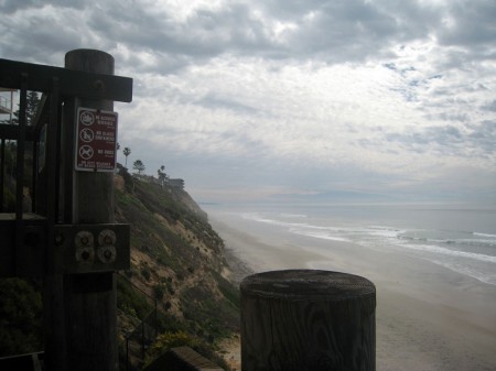
A view of the Pacific from Encinitas. This was the view for many of my rides!
Day 5 – 2/24/09
I really liked the route I took on Saturday and wanted to ride through Camp Pendleton farther north. I parked up in Encinitas, which made for a nice 50+ mile route. There was a good headwind, but coming back was a lot of fun and I was able to open up at 30+ MPH. I got to see lots of Blackhawk and Apache helicopters in action, which was pretty cool.

